|
Also TryMaterialsPapers
- Distance Between Two Points on the Globe (Xerox)
Provides distances, a global map showing two locations, details, such as rivers, driving directions, and much more.
- Earth From the Sky - Close-up (Terraserver - Microsoft)
Provides close-up photographs of many parts of the earth.
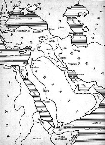
- Map of the Middle East During World War I (Lavarone)
- Map of the World, in Relief (Shaded-Relief.com)
Provides a map of the world, in relief. Visitors may zoom in to city level and view with map mode, satellite mode, or hypbrid. 04-07
- Maps of Countries (Atlapedia)
- Maps of Countries - Terrain (Atlapedia)
- Maps of Countries of the World (CIA Factbook) 1-05
- Maps of different regions of the World (University of Texas)
Caution - each will generally take a long time to load.
- Maps of the World (National Geographic Society)
Provides printable maps by selecting the location on a globe. 7-99
- Maps of the World During World War I (Lavarone)
- Reference Atlas (Maps.com)
"Explore the geography of the world using these online maps." 06-07
|